Image Nano Banana 2
Culinary Cartography: A Spiced Topography of Flavorful Terrain
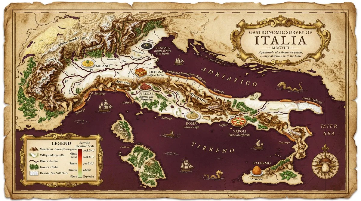
Explore a map where mountain ranges are fiery spices marked in Scoville units, rivers flow with rich sauces, and cities showcase iconic dishes in detailed, historic cartography style.
Prompt
A [MAP STYLE] map of [COUNTRY] where every geographic feature is a culinary element. Mountain ranges are [DOMINANT SPICE] — elevation contours labeled in Scoville units, peaks crusted with visible texture, ridgelines catching light like freshly ground spice. Rivers run with [SAUCE OR BROTH] — wide and glossy at the main arteries, thinning to threads at the tributaries. Valleys pool with [SOFT INGREDIENT], settling into lowlands the way fat settles in a pan. Forests are dense herb gardens, individual sprigs visible at range. Deserts: salt flats. Tundra: cold butter. Every city replaced by its most iconic dish, set in period-accurate cartographic serif. Coastlines fringed with [SEAFOOD OR COASTAL INGREDIENT]. Compass rose built from a single [HERO INGREDIENT], botanically exact. Bottom-left legend translates terrain symbols into ingredients; elevation key runs Mild → Incendiary. Top-center cartouche in aged gilt: "GASTRONOMIC SURVEY OF [COUNTRY] — [FICTIONAL YEAR]." Subtitle in italic: "[ONE-LINE FLAVOR DESCRIPTION]." Aged vellum, foxed edges, wax seal. 17th-century Royal Geographical Society meets a three-star kitchen. 4K, tack sharp, deeply craveable.
Published: April 5, 2026 by @AllaAisling